taylornoakes.com
Skip to content
Home
Interviews
Public History
Published Work
aristide_map1
By
Taylor C. Noakes
|
Published
November 20, 2014
|
Full size is
1479 × 700
pixels
IMG_0544
kissing_hebdo
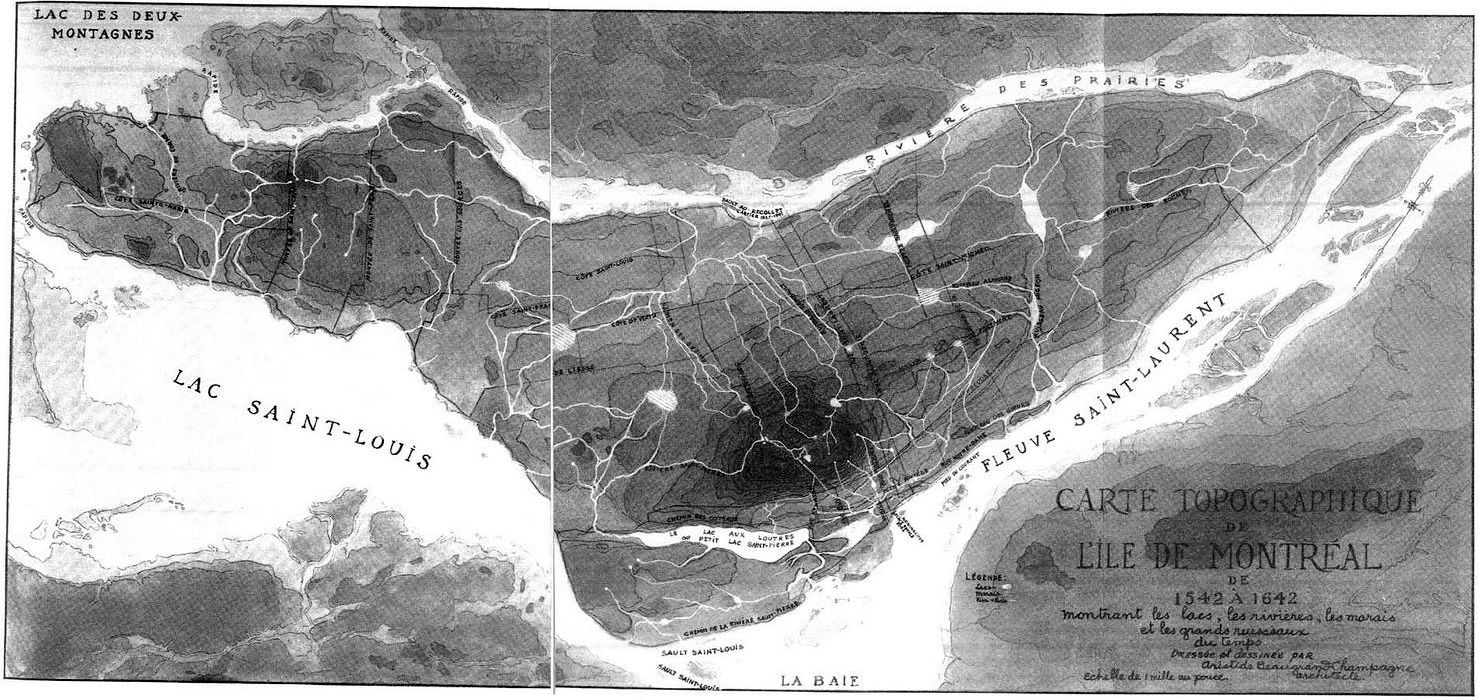
Map of the rivers, lakes and marshes of Montreal Island, as they were charted between 1534 and 1642
Share this:
Share
Click to email a link to a friend (Opens in new window)
Email
Click to print (Opens in new window)
Print
Click to share on Facebook (Opens in new window)
Facebook
Click to share on Reddit (Opens in new window)
Reddit
Click to share on Pinterest (Opens in new window)
Pinterest
Click to share on X (Opens in new window)
X
Click to share on Tumblr (Opens in new window)
Tumblr
Bookmark the
permalink
.

